
England’s June heat record was driven by warm nights
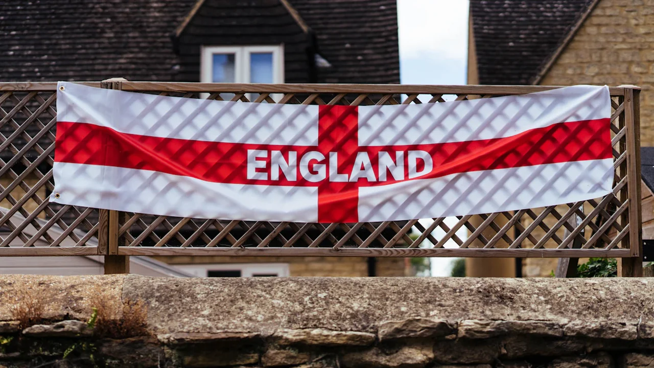
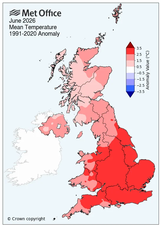
England recorded its warmest June since comparable records began in 1884, with a provisional mean temperature of 17.1°C. That was 2.8°C above the 1991–2020 average and exceeded the previous record set only a year earlier, in 2025.
Across the UK, the mean temperature reached 15.6°C, making June 2026 the second warmest June in the national series, behind June 2023. Wales also registered its second warmest June, while Scotland and Northern Ireland each recorded their joint fourth warmest.
June temperatures across the four nations
The national figures show that the exceptional warmth was strongest in England and Wales, although every UK nation finished substantially above its long-term average.
| Area | Provisional June result |
|---|---|
| UK | 15.6°C, 2.2°C above average; second warmest |
| England | 17.1°C, 2.8°C above average; warmest on record |
| Wales | 15.9°C, 2.5°C above average; second warmest |
| Scotland | 13.0°C, 1.4°C above average; joint fourth warmest |
| Northern Ireland | 14.6°C, 1.6°C above average; joint fourth warmest |
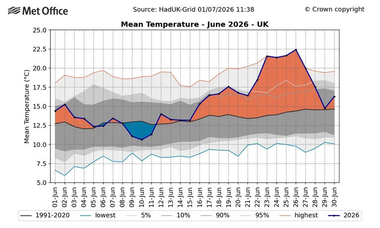
These monthly means combine daytime maximums and overnight minimums across the entire month. They therefore reflect both the late-June heatwave and the cooler, unsettled conditions that came before it.

Record-warm nights lifted the monthly average
The most distinctive result was not limited to afternoon heat. The UK, England and Wales recorded their highest average June minimum temperatures since 1884, with each previous record surpassed by about 0.5°C. Scotland matched its highest figure, while Northern Ireland recorded its second-highest June minimum temperature.
The UK’s average minimum temperature was more than 2°C above normal, and England’s was 2.6°C above average. Frequent tropical nights—when temperatures remain unusually high overnight—helped keep the overall monthly means elevated.
Average maximum temperatures were also high, but did not set national records. The UK and England registered their joint third-highest June maximum averages, while Wales ranked joint seventh. The relatively cool opening part of the month pulled those daytime averages down despite record-breaking heat near its end.
A month split between Atlantic rain and extreme heat
During the first half of June, westerly Atlantic weather brought low-pressure systems, cloud and repeated rain. Around mid-month, high pressure over continental Europe began drawing much warmer air northwards.
The resulting June 2026 heatwave brought exceptionally hot, humid days and unusually warm nights. It also led to the first Red Warning for Extreme Heat to remain in force for three consecutive days since that warning category entered the UK system in 2021.
Rainfall nevertheless finished above average in all four nations. The UK received 90.6mm, equivalent to 117% of its usual June total. Northern Ireland was especially wet at 135.6mm, or 167% of average.
Sunshine reached 104% of average across the UK and 112% in England, but remained below average in Scotland and Northern Ireland. The Met Office said humidity brought haze and cloud during the heatwave, limiting sunshine despite the high temperatures.
How June 2026 compares with the longer record
Five of the first six months of 2026 recorded mean temperatures at least 1°C above average, according to Met Office scientist Dr Emily Carlisle. January was the only month below average. England and Wales had already experienced their warmest spring on record, partly because of an early heatwave at the end of May.
A single monthly record does not, by itself, establish the cause of an individual heatwave. However, Met Office Chief Scientist Professor Stephen Belcher CBE said human-induced climate change has made events of this kind more likely and more intense. Long-term records also show that the UK’s average June maximum temperature has generally risen despite substantial variation between individual years.
How the provisional figures are calculated
The results come from the Met Office HadUK-Grid dataset. Observations collected across the country are interpolated onto a grid with cells measuring 1km by 1km, allowing county, regional and UK-wide averages to be calculated even where observing stations are unevenly distributed.
The June rankings are provisional and may be revised after final quality control. The comparison series used for these national records extends back to 1884, while some observations within the wider dataset date to 1836.
Source: Met Office Weather and Climate News
Context & actions About this article
Source check Source trail
The temperature rankings, rainfall totals and historical comparisons were checked against the Met Office release published on 1 July 2026.
- Compared the reported mean temperatures for the UK and all four nations.
- Distinguished record minimum temperatures from average maximum-temperature rankings.
- Retained the Met Office caveat that the June statistics remain provisional.
- Checked that the national comparison series begins in 1884.
- Source
- Met Office Weather and Climate News
- Scope
- United Kingdom
- Updated
- 2026-07-21 12:49
Source check
Report a trust issue
Send a clear signal to community moderation if the source, facts or context need review.




Comments